Science


Anthropology, Archaeology, Astronomy, Chemistry, Geography, Mathematics, Physics etc.


795 photos
Map of Pacific Ocean with New Guinea and South America showing Magellan's ship Victoria from Theatrum Orbis Terrarum by Abraham Ortelius. Theatrum Orbis Terrarum ("Theatre of the World") is considered to be the first true modern atlas. Written by Abraham Ortelius and originally printed on May 20, 1570, in Antwerp, it consisted of a collection of uniform map sheets and sustaining text bound to form a book for which copper printing plates were specifically engraved.
#030803 6

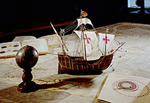
Map of Pacific Ocean with New Guinea and South America showing Magellan's ship V...

Europe, Asia and Africa from a world map by Juan de la Cosa.
Juan de la Cosa (1460-1510, Spanish cartographer, conquistador and explorer) was member of seven voyages to the New World.
#030803 7

Europe, Asia and Africa from a world map by Juan de la Cosa. Juan de la Cosa (1...

Europe from a world map by Juan de la Cosa.
Juan de la Cosa (1460-1510, Spanish cartographer, conquistador and explorer) was member of seven voyages to the New World. Detail of 03-08-03/7.
#030803 8

Europe from a world map by Juan de la Cosa. Juan de la Cosa (1460-1510, Spanish...

The Mediterranean Sea and North Africa from a world map by Juan de la Cosa. Juan de la Cosa (1460-1510, Spanish cartographer, conquistador and explorer) took part in seven voyages to the New World. Detail of 03-08-03/7.
#030803 9

The Mediterranean Sea and North Africa from a world map by Juan de la Cosa. Juan...

Map of the Carribean Islands and the Gulf of Mexico.
#03080310

Map of the Carribean Islands and the Gulf of Mexico.

Maritime chart of the islands of Island and Spitzbergen as well as Lapland, Finland, Norway and Scotland. 1666.
#03080311

Maritime chart of the islands of Island and Spitzbergen as well as Lapland, Finl...

Map of Hispaniola, 1633.
The island of Hispaniola (from Spanish, La Española) is the second-largest island of the Antilles, lying east of Cuba. Christopher Columbus arrived there on December 5, 1492, and on his second voyage in 1493 founded the first Spanish colony in the New World on it.
#03080312

Map of Hispaniola, 1633. The island of Hispaniola (from Spanish, La Española) i...

A drawn map of Siberia by command of Captain Vitus Bering (1681–1741, Danish-born navigator and explorer  in the service of the Russian Navy) in 1729.
Shelfmark: Maps.K.Top.114.43
#03080313

A drawn map of Siberia by command of Captain Vitus Bering (1681–1741, Danish-bor...

Map of Cambridge.
From De antiquitate Cantebrigiensis Academi: libri duo by John Keys, engraved by Richard Line.
London; 1574.
Shelfmark: C.24.a.27
#03080314

Map of Cambridge. From De antiquitate Cantebrigiensis Academi: libri duo by Joh...

Marco Polo with a caravan. Illustration from the "Catalan Atlas". Around 1375.
#03080316

Marco Polo with a caravan. Illustration from the "Catalan Atlas". Around 1375.

Cathay and the Empire of the Great Khan. Cathay is the Anglicized version of "Catai", the name that was given to northern China by Marco Polo (he referred to southern China as Manji). From the World Map by Fra Mauro, 1459.
#03080317

Cathay and the Empire of the Great Khan. Cathay is the Anglicized version of "Ca...

Shipwreck of the Astrolabe under Captain La Pérouse off the island of Vanikoro. Jean François Galaup, comte count de La Pérouse (1741–1788) was a French naval officer and explorer whose expedition vanished in Oceania.
#03080326

Shipwreck of the Astrolabe under Captain La Pérouse off the island of Vanikoro....